HURRICANE
MICHAEL
Press Release
Bertie
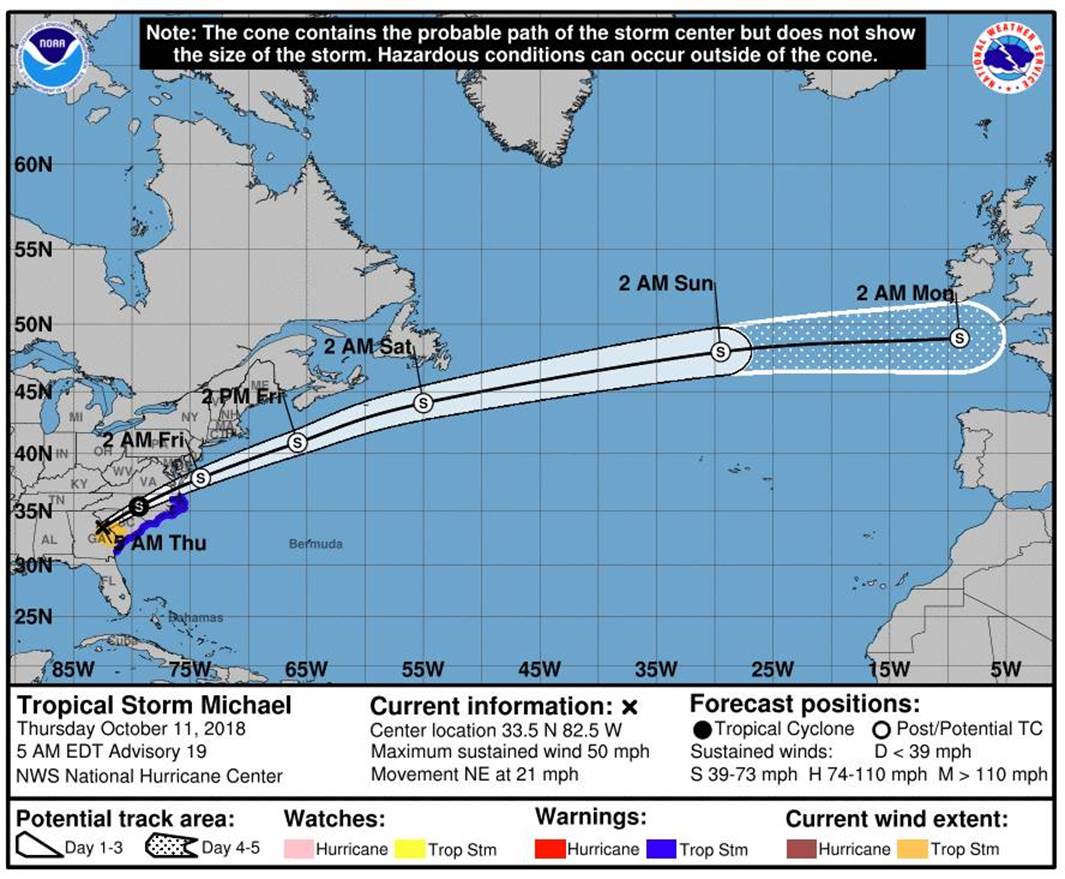
County continues to tract Hurricane Michael
and the track has not changed throughout the
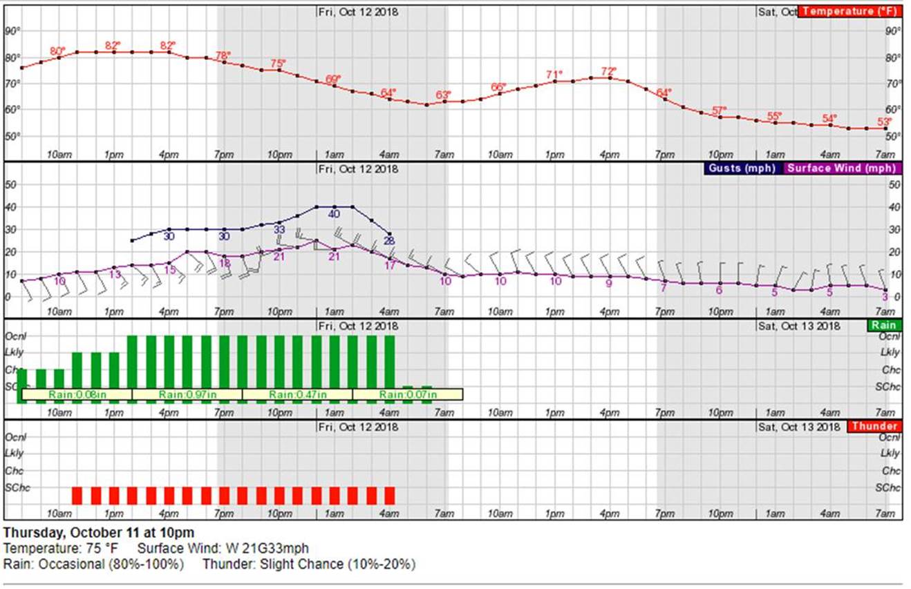
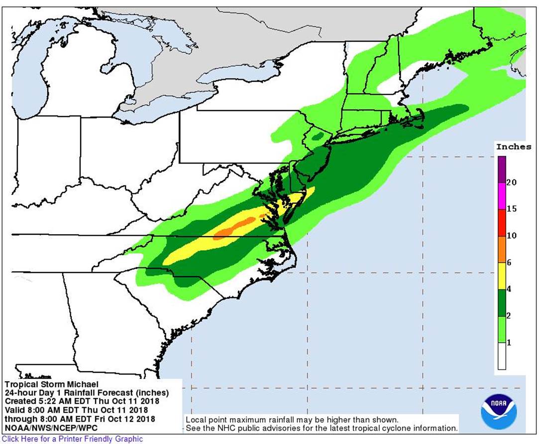
night. Our rain totals are still 2 to 4
inches and possibly 6 inches in some of our
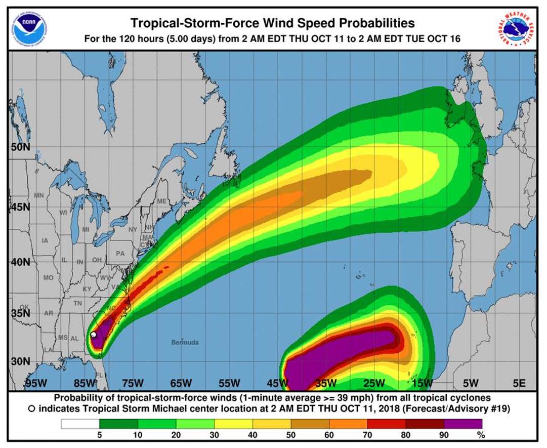
western parts of the County. The winds will
pick up throughout the day with 20 + mph
around 3:00pm and peaking 40 + mph gust
around 10:00 pm through 2:00 am. The
concerns we have for our area at this time
are, when Michael starts to mix with the
cold from we have the possibility of tornado
activity. We will continue to prepare and
send out updates as information comes in. We
greatly apricate everyone taking a proactive
approach and being ready for whatever we
encounter.
Today
A chance of showers
before 11am, then showers likely and
possibly a thunderstorm between 11am and
2pm, then rain and possibly a thunderstorm
after 2pm. Some of the storms could produce
heavy rainfall. High near 85. Southeast wind
7 to 14 mph, with gusts as high as 28 mph.
Chance of precipitation is 90%. New rainfall
amounts between a half and three quarters of
an inch possible.
Tonight
Rain and possibly a
thunderstorm before 5am, then a slight
chance of rain and thunderstorms after 5am.
Some of the storms could produce heavy
rainfall. Low around 62. Breezy, with a
south wind 18 to 24 mph becoming northwest
after midnight. Winds could gust as high as
40 mph. Chance of precipitation is 100%. New
rainfall amounts between three quarters and
one inch possible.
Friday
Mostly sunny, with a
high near 72. Northwest wind 9 to 11 mph.
Friday Night
Mostly clear, with a
low around 51. North wind 3 to 6 mph.