Joaquin
Saturday, October 3,
2015 at 12:30 AM EDT
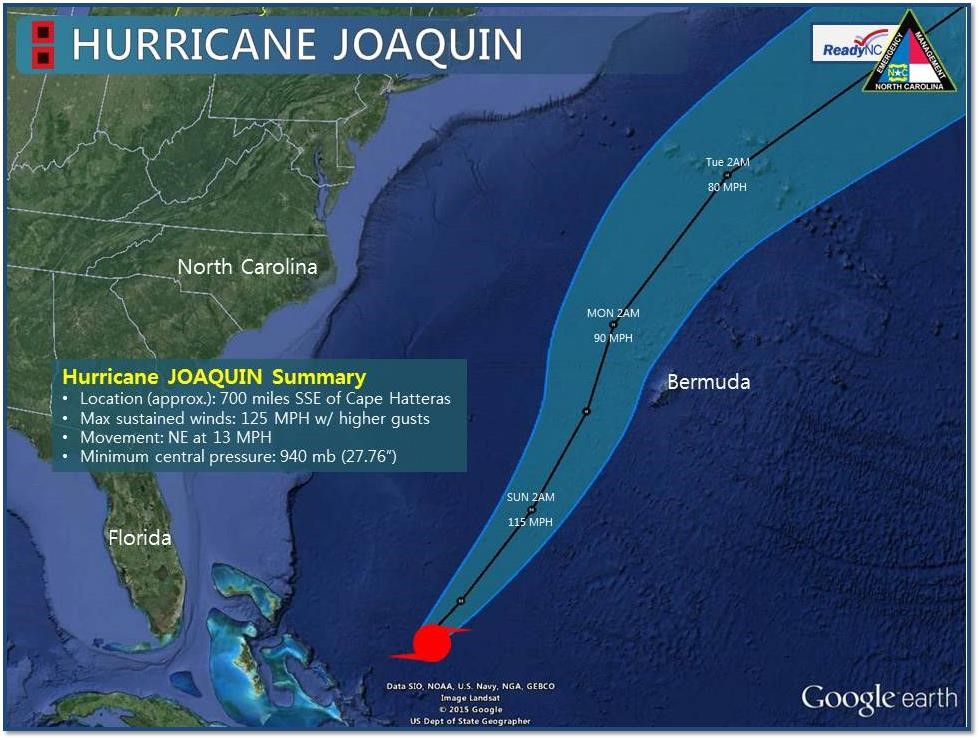
Hurricane JOAQUIN
is located approximately 700 miles
south-southeast of Cape Hatteras.
Maximum sustained winds are 125 MPH with
higher gusts. Movement is to the
northeast at 13 MPH. The general
motion of the storm should continue with a
gradual increase in forward speed over the
next 2 days. JOAQUIN poses no direct
threat to North Carolina, but strong onshore
winds from the storm are causing minor to
moderate coastal flooding, high seas, heavy
surf, significant beach erosion, & the
possibility of overwash (Outer Banks).
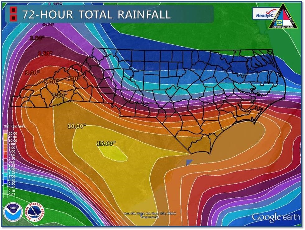
The heaviest rains on
Friday were mainly over southeastern North
Carolina - preliminary estimates indicate
between 6” to 12” of rain possibly fell in
some locations. Rains will diminish
today across much of eastern and central NC.
The mountains, however, will likely see
between 1.5” to 7” of rain with some
locations near the NC/SC border receiving up
to 10”. On Sunday and Monday, the
forecast puts the heaviest rain back over
southeastern NC where an additional 4” to
10” of rain could be added to the event
total. Please continue to monitor the
National Weather Service website, NOAA
Weather Radio, and local broadcast media for
the latest rainfall forecasts and flooding
information for your area.